National Register of Historic Places
- Gaines-Oliphint House (1977): 31.282.59N—93.4526.10W
- Lobanillo Swales (Designation 2016): 31.2839.20N—93.5656.64W
Texas Historical Commission
Antiquities Landmark Archeological & Historic Site
- Lobanillo Swales (Wagon ruts & tracks) – State Antiquities: 31.2839.20N—93.5656.64W
Officially Recorded Texas Historical Landmark Marker
- Cedar Grove Baptist Church (2014): 31.299.65N—93.482.81W
- Clark-James House (2013): 31.1246.85N—93.4542.68W
- Harper Chapel Church (2005): 31.2244.03N—93.430.20W
- Jones-Sweet House (1996): 31.2848.12N—93.552.22W
- Nethery Store (2009): 31.2555.77N—93.5058.16W
- Sabine County Courthouse (1982): 31.2031.20N—93.5057.79W
- Sabine County Jail (1980): 31.2030.35N—93.5058.58W
- Starr Funeral Home (2013): 31.2047.50N—93.5119.13W
- United Methodist Chruch #3 (McMahan’s Chapel (1991)): 31.2719.42N—93.5755.00W
- William F. & Bertha Sutor Goodrich House (2003): 31.2036.62N—93.5055.80W
Officially Recorded Texas Historic Cemetery Markers
- Abney Scurlock Cemetery (1980): 31.2759.67N—93.597.83W (Near Sabine/San Augustine County Line)
- Clark-Dickey-Smith Cemetery (1996): 31.1148.82N—93.4731.05W
- Dennis Slave Cemetery (1982): 31.2555.45N—93.5614.08W
- Ener Cemetery (2006): 31.179.95N—31.179.95N—93.4945.85W
- Fairmount Cemetery (2004): 31.1217.32N—93.4419.81W
- Garlington Cemetery (2001): 31.09.837N—93.43.6000W (Near Sabine/Newton Co. Line)
- Mt. Sinai Cemetery (2004): 31.1234.20N—93.3955.50W
- Oakhill Cemetery (2010): 31.1626.11N—93.4318.88W
- Old Centerview Cemetery (2003): 31.1752.24N—93.031.05W
- Oliphint Chapel Cemetery (1997): 31.2720.22N—93.463.43W
- Payne-Williams Cemetery (1984): 31.2711.53N—93.5418.50W
- Sabinetown Cemetery (1997): 31.2415.12N—93.4244.96W
- Speights-Pratt Cemetery (2010): 31.2414.39N—93.4958.51W
- Spring Hill Cemetery (1999): 31.1811.05N—93.5342.86W
- William Gasby-New Zion Cemetery (1975): 31.2755.80N—93.5555.99W
- Yellowpine Cemetery (2009): 31.1527.62N—93.4918.59W
Officially Recorded Texas Subject Markers
- Bayou (2009): 31.1752.54N—93.4516.29W
- Bethany Baptist Church (2017): 31.264.07N—93.5044.54W
- CCC Camp 2887 F-18-T (2014) (Not yet dedicated): 31.2550.51N—93.4743.34W
- County Line Church & Cemetery (1990): 31.2851.57N—93.5725.0W
- East Mayfield (1997): 31.2029.80N—93.5155.01W
- Hemphill First United Methodist Church (2003): 31.2043.53N—93.5052.66W
- Hemphill (2008): 31.2031.67N—93.5057.86W
- James Taylor Gaines (2016): 31.281.90N—93.4526.95W
- John C. Hale (2006): 31.2557.86N—93.5044.36W
- Las Borregas Camp Site (1973 & 2006): 31.2550.57N—93.5119.41W
- Matthew Arnoki Parker (1974): 31.2342.72N—93.506.01W
- Miai Sculock (1983): 31.2759.67N—93.597.83W
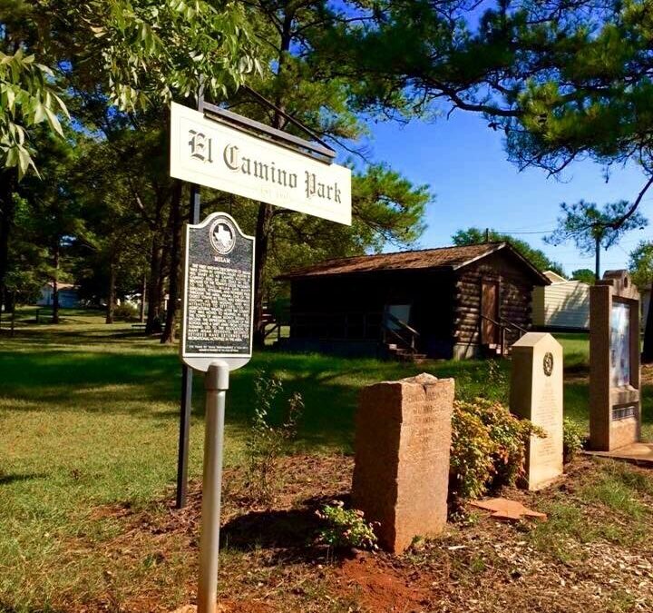
- Milam (2011); 31.2557.81N—93.5050.30W
- Milam Masonic Institute (1974): 31.2557.86N—93.5044.36W
- New Hope-Bethel Baptist Church (1974): 31.2949.08N—93.5048.06W
- Pineland (2010): 31.152.42N—93.5823.97W
- Pineland School (2017): 31.1521.46N—93.5820.99W
- Sabine County (2010): 31.2031.67N—93.5057.86W
- Thomas Johnson School (2015) (Not yet dedicated): 31.215.78N—93.4856.09W
Texas State Centennial Markers
- Barney C. Lowe (1936) (Barnabas Colistus Lowe) 31.935.59N—93.5751.79W
- Francis Marcus Weathered (1936): 31.2611.86N—93.510.32W
- Gaines Memorial Bridge-TexDot (1936): 31.2743.67N—93.4513.56W
- McMahan’s Chapel (1936): 31.2719.16N—93.5754.85W
- McMahan’s Chapel-TexDot (1936): 31.2717.32N—93.5753.99W
- Milam (1936): 31.2557.81N—93.5050.30W
- Sabine County (1936) (Courtyard): 31.2030.40N—93.5057.22W
- Sabinetown (1936): 31.249.54N—93.4236.34W
Texas State Bicentennial Markers
- Sabine County (1986) (Courtyard): 31.2031.67N—93.5057.86W
El Camino Real De Los Tejas National Historic Trail Markers
- Trail Markers No. 1 & 2 (2015): 31.2746.99N—93.452.25W
- Trail Markers No. 3 & 4 (2015): 31.267.52N—93.4658.96W
- Trail Markers No. 5 & 6 (2015): 31.2544.37N—93.4820.52W
- Trail Markers No. 7 & 8 (2015): 31.2557.59N—93.5047.28W
- Trail Markers No. 9 & 10 (2015): 31.2622.12N—93.5328.79W
- Trail Markers No. 11 & 12 (2015): 31.273.97N—93.5436.33W
- Trail Markers No. 13, 14, & 15 (2015): 31.2836.45N—93.554.07W
- Trail Markers No. 16 & 17 (2015): 31.2839.42N—93.5036.66W
Daughters of the American Revolution & State of Texas
Kings Highway – Camino Real – Five Mile Markers
- Texas/Louisiana boundary – Pendleton No. 1 (1918): 31.2743.67N—93.4513.56W
- Two Miles West of Pendleton No. 2 (1918): 31.2632.29N—93.4626.08W
- Milam No. 3 (1918): 31.2557.81N—93.5050.30W
- Geneva No. 4 (1918): 31.2833.22N—93.552.29W
- Intersection Hwy 21 & Spur 35 (1918) (In woods on old Hwy. 21): 31.290.52N—93.5827.34W
Pendleton Crossing Historical Markers
- Blue Star Memorial (1968): 31.2743.67N—93.4513.56W (Sponsors: Hemphill Garden Club, TexDot, & Sabine Co. Commissioners)
- Pendleton 1607-1701 Historic Crossing (1969): 31.2743.67N—93.4513.56W (Sponsor: National Society of Colonial Dames)
- Pendleton 1607-1776 Crossing (1970): 31.2743.67N—93.4513.56W (Sponsor: National Society Daughters of the American Colonist)
- Texas Port of Entry – Texas Limestone Silhouette (1936): 31.2743.67N—93.4513.56W
Geneva Markers
- El Lobanillo Ranch (1972) (Private Funding): 31.2833.22N—93.552.29W
Additional Milam Markers
- Old San Antonio Road – El Camino Real (1974): 31.255.81N—93.5050.30W
War Memorials
- World War I (1918) (Courtyard): 31.2031.80N—93.5057.38W
- VFW Veteran’s Memorial (Ongoing): 31.2029.81N—93.5154.80W
- American Legion Post 517 Plaque (1963): 31.152.35N—93.5823.62W
- Veterans Memorial Park (1999) (Pineland): 31.152.35N—93.5823.62W
Columbia Space Shuttle Memorials
- Columbia STS-107 Star (2003): 31.2055.70N—93.5017.09W
- Columbia STS-107 Monument (2005): 31.2055.70N—93.5017.09W
- Charles Krenek & Jules “Buzz” Miers, Jr. – Memorial (2005): 31.2055.70N—93.5017.09W
- Columbia STS-107 Memorial Marker (2005) (Courtyard): 31.2031.67N—93.5057.86W
Private Markers
- Pratt (1999) (Private): 31.2031.53N—93.5052.71W